search
Spain elevation map
Map of Spain elevation. Spain elevation map (Southern Europe - Europe) to print. Spain elevation map (Southern Europe - Europe) to download. Mount Teide (Spanish: Pico del Teide, IPA: [ˈpiko ðel ˈteiðe], "Teide Peak") is a volcano on Tenerife in the Canary Islands. Its 3,718-metre (12,198 ft)-high summit is the highest point in Spain, the highest elevation point above sea level in the islands of the Atlantic, and it is the third highest volcano in the world measured from its base on the ocean floor (7.500 metre), after Mauna Kea and Mauna Loa located in Hawaii as its shown in Spain elevation map. For this reason, Tenerife is the tenth highest island worldwide. While the lowest elevation point in Spain is the Atlantic Ocean, Mediterranean Sea: 0 m (0 ft) (Sea level).
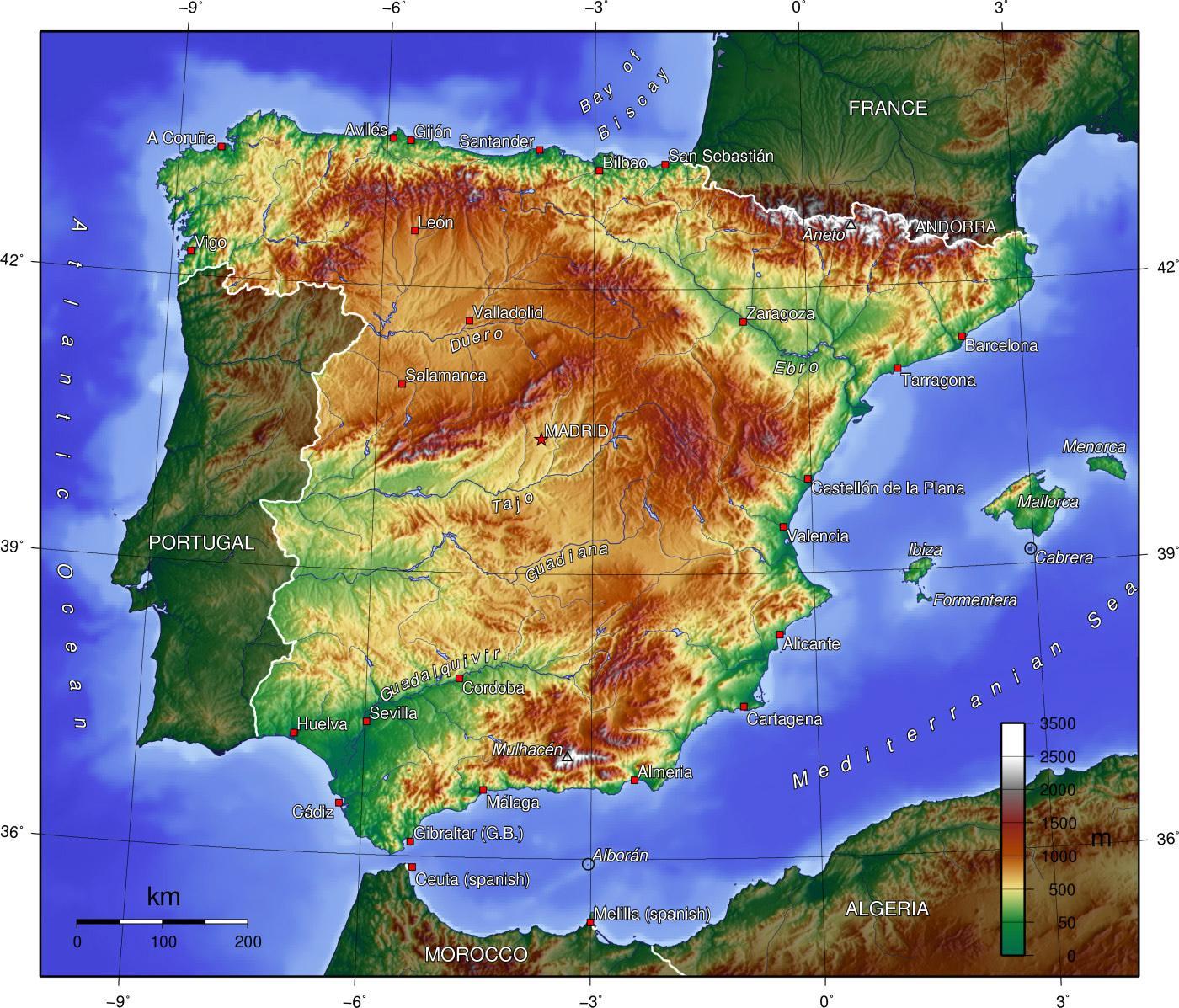
Mulhacén (Spanish pronunciation: [mulaˈθen], Arabic: ملحسن) is the highest mountain in continental Spain and in the Iberian Peninsula with an elevation of 3,478.6 m (11,413 ft). It is part of the Sierra Nevada range in the Cordillera Penibética. It is named after Abu l-Hasan Ali, or Muley Hacén as he is known in Spanish, the penultimate Muslim King of Granada in the 15th century who, according to legend, was buried on the summit of the mountain as its mentioned in Spain elevation map. Mulhacén is the highest peak in Europe outside the Caucasus Mountains and the Alps. It is also the third most topographically prominent peak in Western Europe, after Mont Blanc and Mount Etna, and is ranked 64th in the world by prominence.