
search
Spain roads map
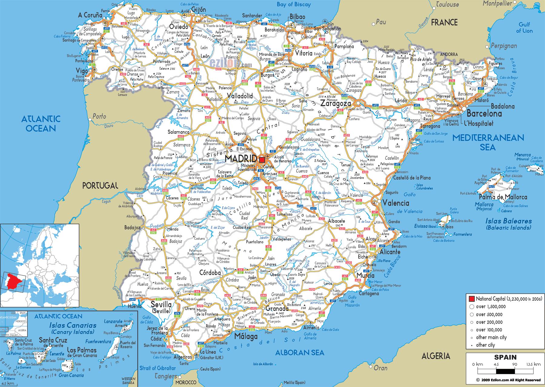
Spain route map. Spain roads map (Southern Europe - Europe) to print. Spain roads map (Southern Europe - Europe) to download. The Spanish road network covers over 300,000km, of which around 8,000km are motorways as its shown in Spain roads map. Although this is a smaller proportion than in most other northern European countries, there are plans to extend the motorway network to some 13,000km by the year 2008, including the completion of the long-awaited Cantabrian motorway and toll motorways such as Las Pedrizas-Torremolinos and Alicante-Villena. Spanish roads have improved considerably in recent years and Spain best roads are now among the finest in Europe, especially the motorways. Unfortunately, these are also among the world most expensive roads and consequently main trunk roads ( carreteras) are jammed by drivers who are reluctant (or cannot afford) to pay the high motorway tolls.
In contrast to the excellent new motorways and trunk roads, many secondary roads in rural areas and small towns are full of potholes and in a dreadful or even dangerous condition. Some main roads are also in poor condition with surprising undulations and dips, and they are not often up to the standards of roads in northern Europe. In 2004, road denominations were changed in order to make them more consistent and easier to understand as its mentioned in Spain roads map. Changing all signs (including the kilometre markers on main roads) and maps is still in progress and you can expect to see roads signposted by their new name, old name or both – not to mention plenty of confused motorists.
Spain road system is made up of motorways and main trunk roads. Numbering systems were updated in 2004 for clarity, and maps produced before this date may not be accurate. On major roads, orange-coloured emergency telephones are placed at 5 Km intervals as you can see in Spain roads map. Lanes may be designated for the use of vehicles with high occupation only (carriles para vehiculos de alta ocupacion, VAO). Drivers can use these lanes if their vehicle weighs less than 3,500 Kg and carries the signalled minimum number of occupants.
Different minimum and maximum speed limits are set according to different types of road. Speed limits may be lower on some roads and will be signposted. Minimum speed limits are indicated on a round blue sign. Maximum speed limits are indicated on a round sign with a red border. On motorways, speed limits may also be indicated on overhead electronic signs as its shown in Spain roads map. Motorway or toll roads: 60 Km/h minimum, 120 Km/h maximum. Main trunk roads (roads with a paved verge of 1.5m or more in width, or with more than one lane): 50 Km/h minimum, 100 Km/h maximum. Other main trunk roads: 45 Km/h minimum, 90 Km/h maximum. Urban areas: 25 Km/h minimum, 50 Km/h maximum.