search
Spain map outline
Outline map of Spain with cities. Spain map outline (Southern Europe - Europe) to print. Spain map outline (Southern Europe - Europe) to download. Spain (officially, the Kingdom of Spain) is divided into 17 autonomous communities (comunidades autonomas, sing. comunidad autonoma) and 2 autonomous cities (ciudades autonomas, sing. ciudad autonoma) as its shown in Spain map outline. The autonomous communities are: Andalusia, Catalonia (Catalan), Madrid, Comunitat Valenciana [Valencian Community], Galicia, Castilla-Leon, Euskadi (Basque) [Basque Country], Castilla-La Mancha, Canarias (Canary Islands), Murcia, Aragon, Extremadura, Illes Baleares (Balearic Islands), Asturias, Navarre (Castilian), Cantabria, and La Rioja. The 2 autonomous cities are: Ceuta and Melilla. The autonomous communities are further subdivided into provinces and smaller subdivisions.
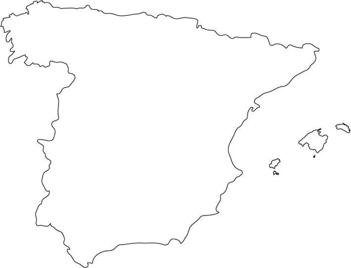
With an area of 505,990 sq. km, Spain is the largest country in Southern Europe and the 4th largest country in the continent of Europe as its mentioned in Spain map outline. It is also the 2nd largest country in Western Europe and EU. Spain has a population of over 47 million, making it the 6th most populous country in Europe and the 4th most populous country in EU. Located in the central part of the country is, Madrid – the capital, the largest and the most populous city of Spain. Madrid is also the cultural, administrative and economic center of Spain. Madrid functions as an important financial hub of Southern Europe.
The above blank outline map is of the European country of Spain, well-known for its unique and vibrant Spanish culture. The map maybe downloaded and printed to be used for coloring or educational purpose. Spain is a country located on the Iberian Peninsula in South Western Europe. It is situated in both Northern and Eastern hemispheres of the Earth. Spain is bordered by 5 countries: by Portugal in the west, by France and Andorra in the northeast, by Gibraltar and Morocco (the Spanish territories of Ceuta and Melilla in North Africa), in the south. The country is bounded by the Mediterranean Sea in the east and southeast, by the Atlantic Ocean in the northwest and southwest and by the Bay of Biscay in the north. Spain shares its maritime borders with Algeria and Italy.