search
Spain population map
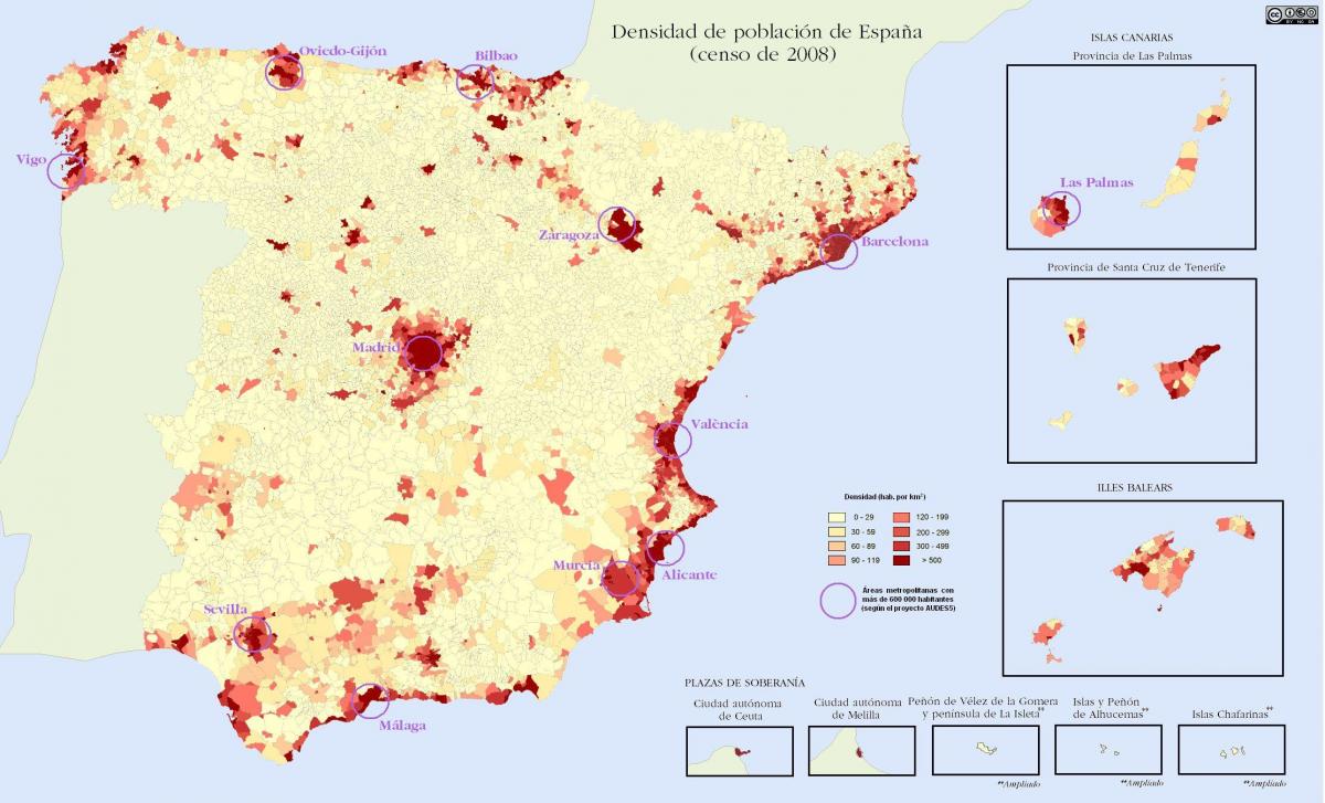
Spain population density map. Spain population map (Southern Europe - Europe) to print. Spain population map (Southern Europe - Europe) to download. Spain has 47,150,819 inhabitants according to 1/1/2010 municipal records (Padrón Municipal) as its shown in Spain population map. Its population density, at 91.4/km² (229/sq. mile), is lower than that of most Western European countries. With the exception of the capital, Madrid, the most densely populated areas lie around the coast. The population of Spain doubled during the twentieth century, but the pattern of growth was extremely uneven due to large-scale internal migration from the rural interior to the industrial cities, a phenomenon which happened later than in other Western European countries. No fewer than eleven of Spain fifty provinces saw an absolute decline in population over the century.
The current population of Spain is 46,764,193 as of Thursday, January 7, 2021, based on Worldometer elaboration of the latest United Nations data. Spain 2020 population is estimated at 46,754,778 people at mid year according to UN data. Spain population is equivalent to 0.6% of the total world population. Spain ranks number 30 in the list of countries (and dependencies) by population. The population density in Spain is 94 per Km2 (243 people per mi2). 80.3 % of the population is urban (37,543,537 people in 2020) as its mentioned in Spain population map. The median age in Spain is 44.9 years.
This statistic shows the population of Spain in 2020, by autonomous community. As of January 2020, Andalusia was the most populated autonomous community in Spain, with a total amount of approximately 8.47 million inhabitants as you can see in Spain population map. Catalonia and Madrid followed closely, with populations amounting to approximately 7.7 million and 6.7 million respectively. Population in Spain has also been analyzed by gender and autonomous community.


