search
Spain topographic map
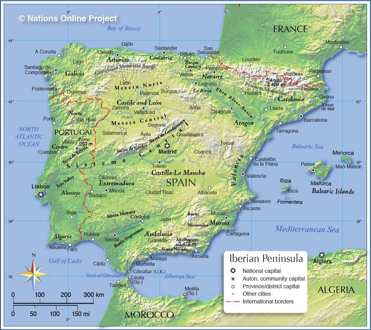
Map of Spain topographic. Spain topographic map (Southern Europe - Europe) to print. Spain topographic map (Southern Europe - Europe) to download. Continental Spain is divided into five general topographic regions: The northern coastal belt is a mountainous region with fertile valleys and large areas under pasture and covered with forests. The central plateau, or Meseta, with an average altitude of about 670 m (2,200 ft), comprises most of Castilla y León, Castilla–La Mancha, and the city of Madrid as its shown in Spain topographic map. Andalucía, with Sevilla its largest city, covers the whole of southern and southwestern Spain and, except for the flat fertile plain of the Guadalquivir River, is a mountainous region with deep fertile valleys. The Levante is on the Mediterranean coastal belt, with Valencia its chief city. Catalonia (Cataluña) and the Ebro Valley comprise the northeastern region.
Spain has six principal mountain ranges—the Pyrenees, the Cordillera Cantábrica, the Montes de Toledo, the Sierra Morena, the Serranías Penibéticas, and the Sistema Ibérico. The principal peaks are Pico de Aneto (3,404 m/11,168 ft) in the Pyrenees and Mulhacén (3,478 m/11,411 ft) in the Penibéticas as its mentioned in Spain topographic map. The main rivers are the Tagus (Tajo), Duero, Guadiana, and Guadalquivir, which flow to the Atlantic, and the Ebro, which flows to the Mediterranean. The Duero and the Guadalquivir form broad valleys and alluvial plains and at their mouths deposit saline soils, creating deltas and salt marshes.
Spain coastline has few natural harbors except the estuaries (rías) in the northwest, formed by glaciers, and those in the Levante and the south, created by sandbars during the Quaternary period. The Canary Islands are a group of 13 volcanic islands, of which 6 are barren. They have a ruggedly mountainous terrain interspersed with some fertile valleys. Spain highest mountain, Pico de Teide (3,718 m/12,198 ft), is on Tenerife as you can see in Spain topographic map. The Balearic Islands are a picturesque group with sharply indented coastlines; they combine steep mountains with rolling, fertile ranges.


